Comments

3-comments
Showing posts with label Maharashtra. Show all posts

Harishchandragad Trek


Trek to Harischandragad is known to be one of the best treks in the Sahyadri ranges and is known as 'Trekkers Paradise'. Harischandragad is a hill fort in Malshej Ghat ranges, in the Indian State of Maharashtra.  There are  three routes to reach Harischandragad Temple . The first route is Nali chi vat- very difficult one, the second  ascends via Khireshwar- also a difficult one and the third ascends via Paachnai- the simple one.

DAY 1

ENROUTE TO KHIRESHWAR VILLAGE

Our route was Mumbai-Kalyan-Malshej Ghat-Khubi Phata-Khireshwar.

We started our journey from Kalyan to Khubi phata at around 10.30 PM by public transport .   At around 1 AM, we reached Khubi phata.  Then a 5 km walk through the mud roads beside Pimpalgaon Joge dam. It was a nice walkway with windy breeze. Reached Khireshwar village  at around 2.30 am and slept in an open space.


DAY 2

VILLAGE LIFE

The dam and the surrounding area offers a scenic view of the area. I walked through the village enjoying village life and sun rise. Farming is done  around the houses. The lush green fields and the houses in the village is a sight to behold.


THE TREK

Post breakfast at the village,  we started our walk.


Then the trek towards Tolar Khind began. There are rock patches in between. Soon we reached Tolar Khind. Tolar Khind also offers a great view of the Konkan hills.


The good thing about this trek is that the way to Harischandragad Temple is well-marked .


Next part of the trek is somewhat dangerous. Here you have to cross vertical rock patches and there are broken railing support in few areas. I had to climb this steep and elevated path .  I started my climb. My legs were shivering. But I managed to climb the path with ease.There was a huge valley beside me.  We were walking through a vertical path full of slippery rocks.


Once you cover the rock patch, a vast area will welcome you. Next part of the trek is a simple walk. It is the place worth visiting for all nature lovers. Its beauty enhances in monsoon season.


There are a couple of huts selling lemon water, buttermilk, snacks etc. The plateau is rich in flora and fauna, lots of wildflowers and butterflies can be seen. There are carpets of Sonki flowers all along the route in the month of October. Then the trek goes through a narrow foot path.  Though the trek is a test of your endurance, it is quite worth for the scenic view it offers. The long stretches of greenery is simply mesmerizing to watch.


As 2016 draws to a close, the mass flowering of Karvi (Strobilanthes callosa) that made the forest all the more special is a sight to behold. The next mass bloom is expected only to be in 2024 now. I have made enough memories of this mass blooming.


The forest  path is a paradise for nature lovers as it hosts several exotic species of wildlife.  Trekking with greenery and fresh wind is a remarkable experience. We identified snakes  butterflies, and birds on the way.


We reached the top of Harishchandragad at around 12.30 p.m.


We rested at a small hut specially made for trekkers.  They served local Maharashtrian food - rice, pittali and pickle. After lunch and rest, we started to explore the surroundings.

HARISHCHANDRESHWAR TEMPLE

Situated at a height of 4650 ft above sea level, this temple has been carved out from a single huge rock.

Legand says that Sant Dnyaneshwar had made the stone wall to walk. He rode the wall to meet Yogi Changdev who rode a Tiger. Changdeve, a mystical yogi turned saint who is believed to have stayed at Harischandragad. The inscription 'Changa Wateshwaracha' on the fort is prominent. 

Behind this temple, a huge Nandi is placed. Behind this Nandi, there is a small underground room.


Around this temple there a few caves and ancient water tanks. The river Mangal Ganga is said to originate from one of the tanks located close to the temple.


SAPTATIRTHA PUSHKARNI

To the east of the main temple is a well-built lake called “Saptatirtha Pushkarni” with temple like constructions on its bank.


KEDARESHWAR CAVE

To the right side of the temple is a huge cave called Kedareshwar. You can watch a big Shiv Ling surrounded by water inside the cave. Forests are nature's design of an efficient and time tested water harvesting system.


CAVES ON HARISHCHANDRAGAD

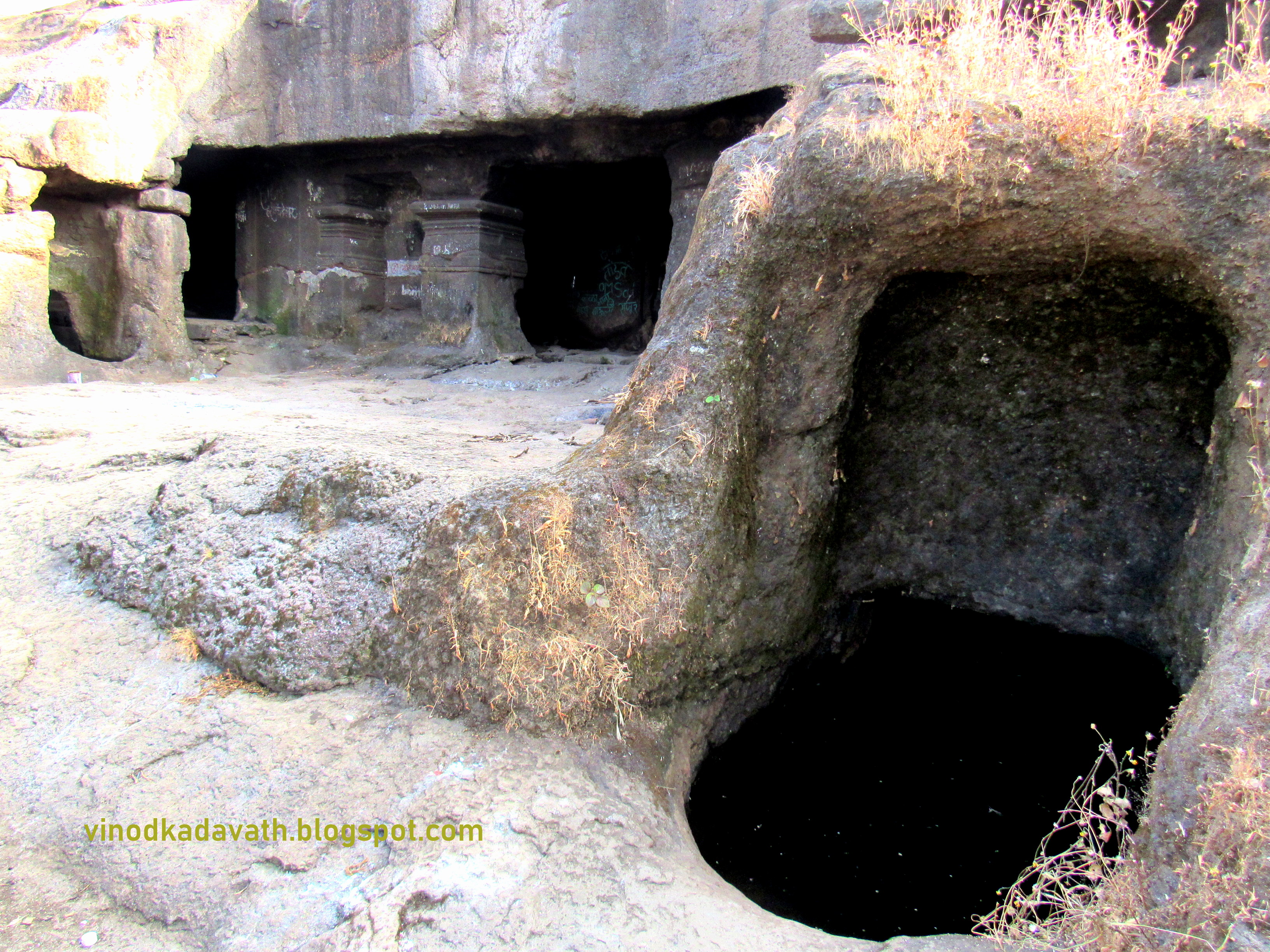
These caves are situated all over the fort. Many of these are situated at the foot of Taramati peak and trekker's using these caves as the place of accommodation. There are small water tanks associated with the caves.

KONKAN KADA (KONKAN CLIFF)

The most interesting point on Harishchandragad is this cliff, which has always fascinated many people for many years. The cliff faces west and looks down upon the Konkan.  It was also here that we enjoyed one of the most beautiful sunset. We sat at the edge of the valley. The climate was so cool, it felt so fresh. I, very conveniently immersed myself in the beauty of the valley. It was a beautiful evening and a memorable one too. And with a view like this, we spent around 2 hours .


It was getting dark and we headed back to the temple area.  It was a long day, indeed. After having dinner, we had fun time with  camp fire, guitar, and songs.


DAY 3

Woke up at 7 AM and our agenda was trek to Taramati peak. Harischandragad is an irregular tabletop with  two peaks, namely Taramati and the Balekilla. There is one more peak called Rohidas peak.

TARAMATI PEAK

This is the topmost point on the fort and is the second highest peak in Maharashtra. Walk uphill to the right of the point and one gets a fascinating view of the Naneghat, Malshej Ghat and the forts near Murbad. One can also see the highest peak Kalsubai, Ratangad, Bhairavgad and Nanacha Angatha from here. It took one hour for ascending and half hour for descending.


After having break fast, we started descending towards the base village. Upon reaching the base village, we had snacks and took a private vehicle to reach the bus stop on the highway.


Enroute passed through the beautiful Malshej ghat. Am sure that one can surely enjoy this adventurous trek.


Unexplored Devkund Waterfalls, Maharashtra


Devkund waterfall is a beautiful waterfall located near Tamhini Ghat, part of Western Ghat mountain ranges in Maharashtra.

ENROUTE TO BHIRA

Started our journey from Dadar, Mumbai at around 6 am in a private bus. En route we had a pit stop at Pali for breakfast. Just half an hour travel from Pali, we reached Bhira Dam which is also the source of the Kundalika river. Kundalika river is famous for its White Water Rafting and I still remember that day, when I went rafting two years back !.  And a walkable distance to the Bhira Village -  the starting point of trek.


STARTING POINT OF THE TREK

Started the trek at around 10.30 AM. The route was small and full of greenery.


We have to cross a river  full of rock patches. As the monsoon season was over,  water was flowing in a narrow lane.


A major portion of the trek route involves walking through the dense forest beside the river.


Spotted an old abandoned house on the route. It is a sight to behold for the wholesome greenery around.

A PIT STOP

Rolling hills and water body lend a surreal  feel to the breathtaking scenery and we had a pit stop here.


The trek path is also scenic and is worth visiting for all nature lovers. Spotted worms, wild flowers and beautiful structure of trees .

Then we reached a vast area . The trail is a treat for the eyes as you soak in the views of lush green vistas and the majestic peaks of Thamani Ghat.


It’s a fascinating and rewarding trek as it takes you along the river.


We had a pit stop near a rivulet for photo session. And the trek continued after crossing the stream.


The rest of the trek was through the dense forest.


We were almost near  the waterfall.  Refreshed myself with water. Then a five minute trek through the rock patches  to reach the waterfalls. Spotted a man fishing.


UNVEILING THE HIDDEN SECRET

At round 1 PM, we reached in front of the water fall. The first sight of the fall was very thrilling. The water fall of  Devkund is amazing and is located inside the forest. The greenery coupled with the water fall makes it a picnic spot.  It was mesmerizing to see water plunging from atop the mountain.


It was an absolute treat playing in the cool natural pond with crystal clear water.  Diving in the pond and getting under the gigantic waterfall provided much relief from the October heat. We spent around one hour for a bath and photography.  A bath below the water fall  was a rejuvenating experience.

LUNCH TIME

After taking some photos,  we bid goodbye to this secret waterfall and started descending at around 2 pm.  Soon we reached  the base village. Had a delicious Maharashtrian lunch - Rice, Dal, pickle, pappad, bhaji etc.


BEAUTIFUL BHIRA DAM AND SUNSET

It was around 5.30 PM and we had decided to visit Bhira dam to enjoy the sunset. Andharben trek also finishes here. Beautiful Thamani Ghat surrounded by lush green vistas in the background and the dam make this area  one of the most beautiful landscapes.


Soon we started our return journey . It was a day very well spent and will be cherished for a long time.

Visapur Trek


Visapur Fort is larger and at a higher elevation than its twin fort- Lohagad.  This place is located near Lonavala which is near Pune in Maharashtra.

ENROUTE TO BHAJA, LONAVALA

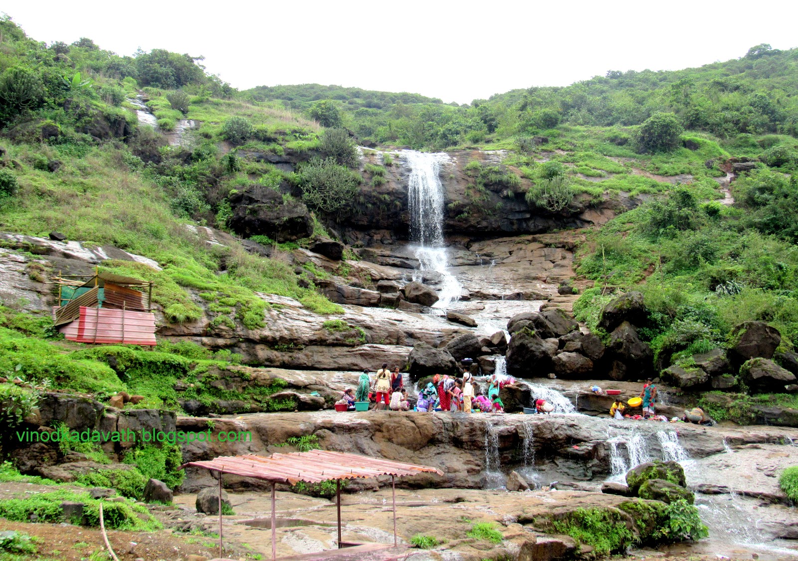
In the dripping wet Mumbai monsoon, it was hard to travel between places. After around 140 kms travel from Mumbai, we reached Malavli. Just 3 kms from the Malavli station, you can reach the base village of  Bhaja,  where ample parking is available. There is a waterfall at the base, which is used for bathing as well as washing clothes. The greenery coupled with the waterfall makes it a picnic spot.

THE TREK

The trek begins from  Bhaja village.  Climbing to the top of the fort, from the base village takes around 2 to 2.5 hours. The walk towards Bhaja Caves is a short climb on a properly laid stairs.

The stairs and the path to the top of the fort get slippery during the monsoons, so one needs to be careful  while climbing. Before reaching the cave area, turn to the left . The route is a little adventurous with a steep walk.

The journey from the base village to the top of the fort is also scenic and is worth visiting for all nature lovers. Its beauty enhances during the monsoon season.


Enroute we rested at a village house. They prepared tea for us.


It was slightly raining and waterfalls were flowing all over. The path was very slippery and we managed to walk through the rocks and the waterfalls.


There are enough sign boards to guide you.

Enroute we spotted small caves curtaining waterfalls.

Heavy rain welcomed us when we reached close to the final lap of the trek.  Walking through the rocky patches during heavy rain is a lifetime experience. Water flowing on the rocks make it more soapy and unsafe.

Rolling hills covered by fog and a series of waterfalls lend a surreal feel to the breathtaking scenery. It was mesmerizing to see water plunging from atop the mountain to the forests.


We were almost near to the top area. Rest part of the trek goes through well laid stairs. You will also find waterfalls enroute to the fort.

We passed by Lord Hanuman’s temple known as Chapetdan Maruti. It takes its name  because of Lord Hanuman's pose to slap the devil that is at his feet. There are small caves and sources for drinking water.

Then we explored fortification on the fort. You can admire ruined stone-built house known as Peshwa’s palace, old grinder, water tanks (known as Taake in Marathi), fort’s wall, secret entrance and carving of Hunuman (Lord Maruti) idol, which is considered as the deity of Visapur fort.

Set at an altitude of 3556 ft Feet above MSL, the fort area is too vast and it takes around two hours to see the places on the top of the fort. Majority of the walls is still intact. From this fort, you can see other forts such as Lohagad, Tikona and Tung.

Escape route or secret route, Visapur Fort

The ruins of a large stone-built house are known as the Peshwa’s palace . We were walking in clouds and unable to see any natural beauty around the fort.  Walking with greenery and fresh wind makes life easier here.

Then we started descending.  It was a beautiful walk and a memorable one too. During monsoons the trail to the top is an amazing experience with heavy fog, rain and wind all around.

Malshej Ghat


Malshej Ghat, famous for its waterfalls and thick mist, is situated at an altitude of 700 metres (2300 feet) above the sea level.

Route Map : Mumbai -> (Eastern Expressway) Borivali ->Thane -> Bhiwandi -> Kalyan -> Murbad ->Sarlagaon -> Malshej Ghat.

A four hours journey from Mumbai will take you to Malshej Ghat.

ENROUTE TO MALSHEJ GHAT

Making our way to Malshej ghat through the lonely roads ! Immersed in the beauty of the surroundings, I looked out of the window, not wanting to miss anything.


Soon we were truly in  natures lap. We stopped  at few places to click photos of  the picturesque scenery around.  It is a sight to behold for its wholesome greenery, village life and a layer of mist as clouds descend into the region.


We were on the highway. The sun blazed high on the sky, as the distant mountains flew past into the blur, some of them still covered in a thin layer of snow. These lofty ranges were constant companions and unsurprising.


The road stretched on ahead with dozens of curves. Further on, was a series of waterfalls plunging into the road.


Almost at every curve of the road, one is bound to find a cascading waterfall.  Walking through the gushing water is a lifetime experience.

AN ATTRACTIVE TUNNEL

Enroute to the village is a tunnel. This was the route's attraction.


The road is extremely narrow but the overhanging greenery more than makes up for the alert drive. After crossing the  tunnel , we saw a beautiful creation of nature’s architecture – a cliff at the edge of a small plateau. It’s a place from where you can get a view of the entire ghat.

Krishna Bela Point. Malshej Ghat

There were  stalls on the way and were the only sources for  snacks and water. They were selling tea, coffee, egg dishes, vada pav and roasted corns.

VILLAGE

After clicking a lot of photos, we headed towards the  village which was a few kms ahead from Malshej Ghat.

BEAUTIFUL LAKE

Just adjacent  to the road is a beautiful lake -Pimpalgaon Joga Lake - which is one of the main attractions in Malshej Ghat. The surrounding was so  nice that I could not  resist myself from clicking photos.


Rolling hills and the gathering clouds lend a surreal feel to the breathtaking scenery.

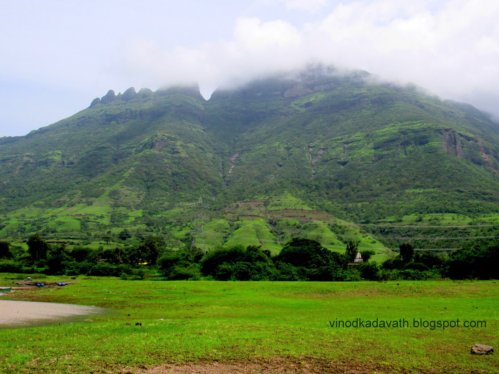
Mountain in Monsoon,Malshej ghat

VILLAGE LIFE
People working in paddy field during monsoon at Malshej ghat

Had a delicious Maharashtrian lunch - Rice, Dal, Pithla Bhakri, Maas wadi etc.


VIEW POINT

The view from behind the ‘Flamingo Hill Resort’, run by MTDC is a must-see.  Covered with a misty fog,these mountains often seem to merge and disappear into the skies.

A distance view of Krishna Bela point.

If  planning to stay overnight, one can consider  ‘Flamingo Hill Resort’ run by Maharashtra Tourism Development Corporation.

As we were on high altitude, the clouds were on the road and this is an  experience which I love – passing through the clouds.


Malshej Ghat is a must visit weekend destination during the monsoons.