When I was standing at the top of Kathirumudi mountain a year ago, I got the magnificent view of Agasthyakoodam. Since then it was a wish that I had kept in my mind to reach the top of Agasthyakoodam and take the blessings of Agasthya Muni.
I booked my seat in December for the 3 days Agasthyakoodam trek which started on 12 th Feb, I started my preparations both physically and mentally. With a simple mission of being fit I started walking each morning. And was extra cautious in my diet to maintain my health. Usually season pilgrimage to Agasthyakoodam starts in January for two months. This year there was no season to Agasthyakoodam due to Covid 19 and only special pass entry is allowed.
Finally the day came. On 11th February evening four of us started from Ernakulam in a private car. Ended our day with a sound accommodation at Rohini International, Vithura. Had a good sleep.
Day 1 : 12 February 21 - All geared up for the trek. 18 km from Bonakkad to Athirumala Base Camp.
Had breakfast and assembled at Vithura at around 7.30 am. It is around 14 kms from Vithura to Bonakkad. There is a check post on the way - Kanithadam checkpost and one need to take permission to enter the area. From there, the hill range starts. There are few hairpin bends on the way to Bonakkad.
The trek starts from Bonacaud picket station. After checking the entry pass, photo id and Covid Negative certificate , we started our trek at around 9.30 am with packed lunch. It is only after we vow to respect the forest and its inhabitants that we gain entry to one of the important parts on the Western Ghat ranges.
The Agasthyakoodam is valued by scientists for its unparalleled biological diversity, as it is home to more than 300 rare birds and over 2000 medicinal plants. found nowhere else. The rivers, Karamanayar, Neyyar and Thirunelveli originate from this place. This place is also lush together with Chenthuruni, Peppara, Neyyar and Kalakkad Wildlife Sanctuaries. The peak is located within the Neyyar Wildlife Sanctuary.
The initial stretch from the picket station is through thick deciduous and semi-evergreen forests. There are five camps in between Bonacaud Picket Station and Athirumala base camp, around two kilometers apart. We stopped some time at the gushing Karamanayar river and had an energizing bath and a well deserved lunch.
 |
| Karamanayar river |
I walked through the forest and meadows gurgling with small rivulets. After crossing lathimotta camp, Karamanayar river and Vazhapaithyar camp , we reached Attayar camp. From here the trek becomes slightly more challenging due to the rapid ascend into open grasslands. I fell into a rhythm, enjoying the simplicity of walking. A little further ahead of the Attayar Camp, you get the first glimpse of the towering Agasthyakoodam Peak. This stretch is dangerous as there is a chance to see wild animals.
Once you cover the grasslands, the final stretch to Athirumala involves a vertical climb through evergreen forests. We could hear the sound of a Sloth Bear in the distance all along the way.
And the humble signboard welcomed us to the Athirumala Base Camp .
It would be anywhere between 5 pm by the time we reached the base camp. Upon reaching, the authorities verified our pass. Dumping my luggage, I straight dashed off for a Kattan Chai (black tea).
Athirumala base camp has four sheds covered by metal sheets in blue color and another small area for cooking. The site was protected from wild animals by a moat and has all basic amenities for bath and toilets in decent condition .
There is a small river flowing beside the camp site. There was no power connection to the camp site and it was fully dependent upon solar energy. As per the camp rule, all lights will be switched off at 9 pm. By 8 pm, our dinner was ready. The staff were so friendly and they served us hot vegetarian food - rice, sambar and pappad.
They supplied mat and common shed for multiple teams. I realised how cold it was outside before crawling into my sleeping bag. And heavy wind began to drum a beat on the metal sheet. I was warming in my sleeping bag.
Day 2: 13 Feb 21 : Today was the day to accomplish our goal to reach the top of Agasthyakoodam. 6km from Athirumala Base Camp and back.
When I stepped out of shed, I saw the magnificent view of Agasthyakoodam. The sky was clear.
 |
| A view of Agasthyarkoodam from the base |
Named after Agasthya, the most respected Vedic sage of Hinduism, whose final resting place was on its peak, Agasthyakoodam or Agasthyarkoodam, was declared as Biospeare reserve on March 19, 2016. The peak of Agasthyarkoodam can only be reached by trekking to it
There is an interesting mythological story about this place. During the marriage of Lord Shiva and Goddess Parvati, all the Gods, the great sages and many other creatures traveled to Mt. Kailasa. . As a result of this huge gathering, the northern part of the land plunged. Lord Siva summoned Agastya and bade him to go south, to restore the balance of the earth. Accordingly, the Rishi then traveled south. Alas, Agastya established his residence on the south, and never went back to the north. With his presence in the south, the weight of his ascetic merit served to restore the balance of the world.
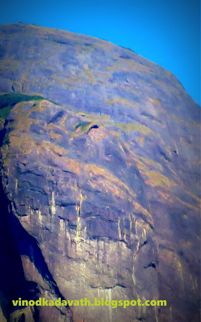
When I tried to zoom the middle portion of the mountain, I could see Agasthya, In the end, our devotion makes one place holy and we could see the divine everywhere.
Freshened up with the super cold water, got ready with packed lunch and at around 8 am, with the hope of good weather, a group of 29 enthusiasts, headed to the terrain of Agasthyakoodam which is a trek uphill. It is located at an elevation of 1868 meters from sea level, each of us along with guides was ready to conquer the challenges of terrain and make spectacular memories along the way.
To keep our luggage light, we carried only water bottles, snacks and a cap for sun protection apart from our packed lunch. The gradient is moderate plus to difficult through dense forest, bamboo covers and steep rocky climb. Rivulets and small waterfalls doted the way.
When we go up, we could see the camp site as a blue spot below amidst the greenery.
After around 1.5 kms, the forest cover thins out into a rocky bamboo trail. You will also be greeted with majestic views of the Agasthyakoodam peak along with mesmerising views of the valley down below.
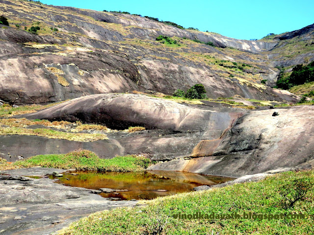
At around 2.5 kms, the trail opens out into a large rocky area with a narrow stream cutting across the middle and the Agasthyakoodam peak now standing intimidatingly on your right.
Cross over the stream and climb up the other side across a ridge to reach another wide open area called ‘Pongalappara’ . I stepped carefully over the rocks.
One could say this is from where the actual climb starts as the rocky plains now merge yet again into a narrow bonsai forest trail with almost 2 kms left towards the peak. This place is known as Muttidichanmala. It is an oasis of green amid the mountains surrounding it.
The trail now climbs over three vertical rock surface, one after the other. The ropes provided here help you to an extent to make this part of the climb which ultimately lead to the topmost point.
It is customary to go barefoot in the final rock patch, So I climbed barefoot..
Finally at the top!!! By 12 pm, we reached the top of Agasthyarkoodam. This is the place I really wanted to visit for the past several years and I consider this as a major highlight in my life.
This is the perfect spot for peak viewing. The citadel with its monastery looks spectacular with a fine line of clouds and the summit of the five peaked mountain range- Pandavan Mala- as a backdrop. Another popular views from the peak are Peppara and Neyyar Dams. We were engaged in clicking pictures. I just sat there for few minutes. It was awe inspiring.
A small patch of forest in the middle of the peak is home to the revered shrine of Agasthya Muni, well protected from the strong winds. Then I offered prayers and that was enough to fill my heart.
 |
| Murti of Agasthya Muni at the top of Agasthyamalai hill |
After taking the blessings of the Hindu seer, we started our descend. The descend being almost as adventurous as the climb. We took a halt near Pogalapara. Had an energizing bath and took rest for some time till other team members reached. That night, I had a tasty meal of homemade food - rice, sambar, kuttu curry and pickle.
Day 3: 14 Feb.21- Back to Bonakkad…End of the trek
Started our trek back to the Bonacaud Forest Check Post by 8 am in order to avoid the harsh sun later on during the trek. The return journey is via the same trail used to reach the basecamp on day one. And I reached the Picket station by 1 pm. Without a second thought I can say it is one of the best and most relaxed trek I had till date and will be cherished for long.


Excellent post...Well done
ReplyDelete